GIS4Peace – Peace. A possible space. Tuesday 1 December 2026, Assisi
Maps don't pick a side.
We do.
2026
- Tuesday9:00 – 17:30
- WhereSala della Conciliazione, Assisi
Free admission

GIS4Peace
Geospatial technologies have military origins, and even today they are mostly associated with tactical use: identifying a target, planning an operation, controlling a territory. That is only part of the story.
The same satellite images and analysis tools are used to:
-
Documenta violation, to make it provable.
Comparing two satellite images of the same place shows what has changed. With verified data and cross-checked sources, that difference becomes evidence that can be brought before institutions and courts.
We discuss it with Samanta Paladino Amnesty International Italy and Lorenzo Vita UNODC.
-
Protectpeople and territories, before the crisis arrives.
Drought, floods, conflict: many crises give warning before they erupt. Combining satellite data with information about the territory makes it possible to identify the most exposed areas, raise the alarm in time and step in before the most vulnerable people pay the price.
We discuss it with Rohini Sampoornam Swaminathan UNICEF and Federica Chiozza FAO.
-
Reachcommunities that no map shows.
Informal settlements, camps for displaced people, villages and isolated rural areas: where official maps do not reach, aid is delivered blind. Mapping them puts them into intervention plans.
We discuss it with Valerio Salvitti JRC and Irene Freni Médecins Sans Frontières (MSF).
To show that a map can be an instrument of peace, we chose the right place: Assisi, eight hundred years after the death of Saint Francis.
Those who work for peace and those with geospatial expertise work today on parallel tracks and rarely meet: the goal of the day is to bring them together and build a lasting alliance from here.
Program
Talks marked with this flag are in English; the others are in Italian
Morning
Moderated by Prof. Flavia Marcacci
-
Registration and welcome coffee
-
Welcome addresses
- Antonio Natale, creator of the event and Technical Director, TeamDev Ecosystem
- Valter Stoppini, Mayor of Assisi
- Fabio Barcaioli, Councillor of the Umbria Region
- Massimiliano Presciutti, President of the Province of Perugia
- Flavio Lotti, President of the PerugiAssisi Foundation for the Culture of Peace
- Daniel Lurie, Mayor of San Francisco
- Jack Dangermond, Esri
- Massimiliano Mazzer, Esri Italia
- Andrea Cruciani, President of the Innova I-Hub association and CEO of TeamDev Ecosystem
-
Mapping Common Ground
GIS supports peace through two powers: informative, turning data into shared evidence, and convening, bringing stakeholders to one table. With examples from core GIS use cases, this keynote shows how the two combine to do what peace needs most: map common ground.
-
Gathering evidence, building justice
Samanta Paladino, Amnesty International Italy
Satellites, video and weapons analysis help Amnesty International reconstruct what happened, link facts to responsibility and put people back at the center. When those taking part in a war try to hide their tracks, even a map can become part of the evidence.
-
Geospatial information for peace and security: UNODC's experience
Integrating remote sensing and GIS enables UNODC to generate geospatial evidence that supports strategic analysis and public policy, contributing to the stability, security and resilience of territories.
-
Where Risks Converge: Using Geospatial Evidence to Prevent Humanitarian Crises and Support Peace
Rohini Sampoornam Swaminathan, UNICEF
Geospatial technologies are often associated with crisis response, conflict monitoring, and disaster management. Yet their greatest contribution to peace may lie further upstream: helping governments, humanitarian organizations, and communities identify emerging…
Geospatial technologies are often associated with crisis response, conflict monitoring, and disaster management. Yet their greatest contribution to peace may lie further upstream: helping governments, humanitarian organizations, and communities identify emerging risks before they become emergencies.
Drawing on experiences from different UN agencies, this presentation explores how geospatial analysis can support a prevention-oriented approach to peacebuilding. By combining Earth observation, climate and socioeconomic data including measures of child vulnerability, geospatial intelligence can reveal where overlapping pressures such as drought, flooding, food insecurity, displacement and lack of access to social services are creating conditions that threaten human security.
The presentation will demonstrate how spatial evidence has been used to support anticipatory action, preparedness planning, resource prioritization and equitable service delivery in fragile settings. It will also introduce emerging work on the Global Child Hazard Database, which brings together multiple dimensions of risk affecting children and provides a foundation for understanding how climate, environmental and social stresses converge geographically.
-
Mapping agrifood systems, understanding the territory: FAO's geospatial information in fragile contexts
Protracted crises, extreme weather events and conflicts have profound consequences for agricultural systems, access to natural resources and food security. Understanding the extent and distribution of these impacts is particularly complex in territories where…
Protracted crises, extreme weather events and conflicts have profound consequences for agricultural systems, access to natural resources and food security. Understanding the extent and distribution of these impacts is particularly complex in territories where direct access is limited or impossible.
FAO's Geospatial Unit of the Land and Water Division uses high-resolution satellite imagery, artificial intelligence and geospatial analysis technologies to monitor land transformations, assess damage to agricultural areas and productive infrastructure, and analyse the effects of emergencies on agrifood systems.
By integrating Earth observation data, agricultural statistics and socioeconomic indicators, these analyses make it possible to fill important information gaps, providing concrete evidence to assess the impacts of crises and guide emergency and recovery interventions.
-
GIS-Driven Situational Awareness for the European Commission: mapping disaster- and conflict-impacted countries
Geographic Information Systems (GIS) are increasingly important for supporting humanitarian action in areas affected by disasters, conflict, and displacement. By combining information on hazards, population distribution, accessibility, infrastructure, and…
Geographic Information Systems (GIS) are increasingly important for supporting humanitarian action in areas affected by disasters, conflict, and displacement. By combining information on hazards, population distribution, accessibility, infrastructure, and vulnerable communities, GIS helps humanitarian organizations better understand the needs and how assistance can be delivered most effectively.
This presentation highlights the role of GIS through examples from DG ECHO Daily Maps (operational products that provide an overview of a significant event or situation on a daily basis), produced by the JRC ECML team. Using case studies from Syria, Myanmar, and Ukraine, it explores both the methods used and the challenges encountered when mapping the impacts of natural and human-induced disasters in conflict-affected areas. The examples include the 2023 Türkiye-Syria earthquake, the 2025 Myanmar earthquake, the 2023 Nova Kakhovka Dam breach, and the 2026 pollution event affecting the Dniester River.
These events demonstrate how disasters often interact with pre-existing vulnerabilities, including conflict, population displacement, and complex humanitarian emergencies. In addition, this presentation highlights the methodologies used in the production of DG ECHO Daily Maps, as well as the challenges of assessing humanitarian impacts in contexts where reliable information is scarce or access to affected areas is restricted. In such situations, geospatial analysis provides an essential source of evidence, supporting situational awareness, impact assessment, and informed decision-making.
GIS is more than a tool for mapping disasters. It helps identify affected areas and populations, assess accessibility constraints, understand potential humanitarian impacts, and support the response efforts. GIS helps the humanitarian community to better understand where hazards, vulnerability, and conflict intersect, enabling more informed and timely decisions during emergencies.
-
GIS at MSF: from tool of War to tool of Care
Irene Freni, Médecins Sans Frontières (MSF)
Maps are often, and increasingly, associated with war. At MSF, the GIS Centre helps reverse this paradigm. We use GIS to produce maps that support operational decision-making and humanitarian medical action, improving access to care for communities affected, among…
Maps are often, and increasingly, associated with war. At MSF, the GIS Centre helps reverse this paradigm. We use GIS to produce maps that support operational decision-making and humanitarian medical action, improving access to care for communities affected, among other crises, by conflict in fragile contexts.
-
Q&A with the speakers
-
What a map doesn't say: building the civilization of love
Simone Tropea, Corpus International
A map shows borders, destruction, displacement. It does not show the faces of those who live through them. From the war zones of Ukraine and the Holy Land, a reflection on technology, ethics and the person: for data to become peace, knowledge of the territory must…
A map shows borders, destruction, displacement. It does not show the faces of those who live through them. From the war zones of Ukraine and the Holy Land, a reflection on technology, ethics and the person: for data to become peace, knowledge of the territory must become care for others.
-
Close of the morning session
Afternoon
From 14:30 to 17:30, in the Sala DigiPASS in Santa Maria degli Angeli – Palazzo del Capitano del Perdono, Piazza Garibaldi
The workshop and the mapathon are held in Italian.
Technical GIS workshop
14:30 – 16:00
A hands-on session led by TeamDev Ecosystem's team of GIS experts. Participants work on concrete use cases: from using satellite imagery and geographic data to building maps and analyses that document a territory and support decisions.
- What to bringYour own computer, if possible.
- SoftwareThe free versions of ArcGIS are used.
- Training creditsFor professionals, to be agreed with their own professional body.
- RegistrationSame as for the event: select the afternoon in the form.
Mapathon
16:00 – 17:30
Held in collaboration with Map For Future, a volunteer mapping lab that uses digital cartography and OpenStreetMap to support the most disadvantaged areas of the world.
- What to bringYour own computer, if possible.
- Training creditsFor professionals, to be agreed with their own professional body.
- RegistrationSame as for the event: select the afternoon in the form.
Closing of the event
Watch live
The morning session of GIS4Peace will be streamed live on YouTube, from 9:30 to 13:30. The live link is reserved for registered attendees; after the event, the video will be published here.
Who's speaking
Eight talks from the United Nations, European institutions, humanitarian and human rights organizations, journalism and the geospatial industry.
-
OC
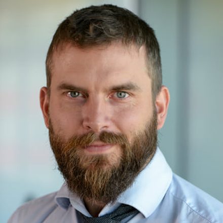
10:30, opening keynote
Olivier Cottray
Esri
Director of Humanitarian Solutions
Mapping Common Ground
Olivier Cottray is director of Humanitarian Solutions at Esri, where he helps relief organizations get the most out of Esri solutions and develops best practices for the global humanitarian GIS community. Prior to joining Esri, Cottray led the Information Management Division of the Geneva International Center for Humanitarian Demining (GICHD) where he developed and implemented the Information Management System for Mine Action (IMSMA). Before focusing on remnants of war, he helped optimize and complement the logistics of cooperating agencies at the UN Joint Logistics Centre. He first applied GIS for humanitarian aid in 2002, when he helped found MapAction to provide rapid information management and GIS support following a crisis.
-
SP
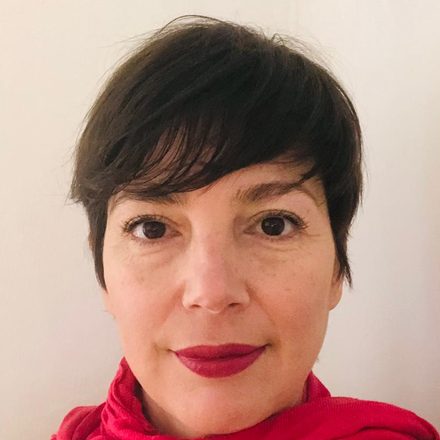
10:50 · Document
Samanta Paladino
Amnesty International Italy
Head of Digital Unit
Gathering evidence, building justice
A digital communications professional with over 18 years of experience. She has developed and led Amnesty International Italy's digital presence since its beginnings and today coordinates the Digital Unit, working on online communication strategies and campaigns.
-
LV
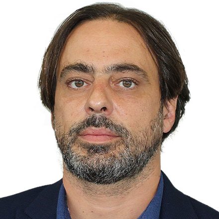
11:10 · Document
Lorenzo Vita
UNODC
Geospatial Information Officer, Illicit Crop Monitoring Programme
Geospatial information for peace and security: UNODC's experience
He has built his career in Geographic Information Systems (GIS) and environmental research. He is now Geospatial Information Officer at the Illicit Crop Monitoring Programme (ICMP) of the United Nations Office on Drugs and Crime (UNODC) in Vienna, and has contributed to the design and implementation of technical assistance programs for national illicit crop monitoring systems.
-
RS
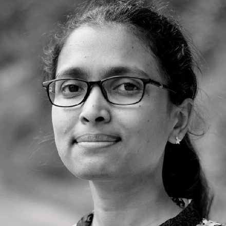
11:30 · Protect
Rohini Sampoornam Swaminathan
UNICEF
Climate and Environment Data Unit
Where Risks Converge: Using Geospatial Evidence to Prevent Humanitarian Crises and Support Peace
Rohini Sampoornam Swaminathan is a geospatial expert with nearly 15 years of international experience working with the humanitarian and development sectors. She currently serves with the Climate and Environment Data Unit at UNICEF and previously worked with UN WFP, WHO, UNDP, UNITAR and the NASA DEVELOP program. Rohini holds a Bachelors and Masters in Geomatics Engineering, and an MBA and PG Dip. in Environmental Law.
-
FC
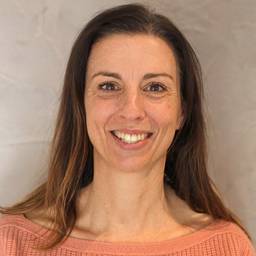
11:50 · Protect
Federica Chiozza
FAO
Land and Water Officer, Geospatial Unit
Mapping agrifood systems, understanding the territory: FAO's geospatial information in fragile contexts
Land and Water Officer in the Geospatial Unit of FAO’s Land and Water Division since 2018. She holds a degree in Natural Sciences, specialising in Biodiversity Conservation and Management, and has extensive experience in the use of geographic information systems (GIS), remote sensing and Earth observation data for land-use analysis, agricultural monitoring and biodiversity conservation. Since 2004 she has worked as a GIS expert for FAO and the World Bank, also collaborating with Sapienza University of Rome and the International Union for Conservation of Nature (IUCN).
-
VS
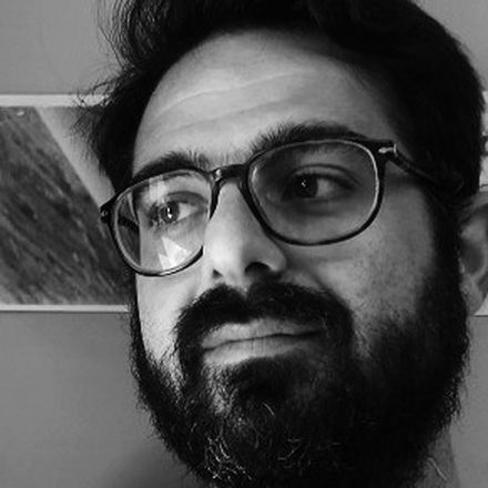
12:10 · Reach
Valerio Salvitti
JRC, the European Commission's Joint Research Centre
Geologist and GIS Analyst
GIS-Driven Situational Awareness for the European Commission: mapping disaster- and conflict-impacted countries
Valerio Salvitti is a Geologist and a GIS Analyst at the Disaster Risk Management (JRC.E.1) Unit of the Joint Research Centre in Ispra (Varese, Italy). Since 2018, he has been responsible for the daily situational awareness activities, including the Daily Map and Daily Flash, which show and report unfolding natural and man-made disasters and major humanitarian crises across Europe and globally. Additionally, he contributes to the development and improvement of the Global Disaster Alert and Coordination System (GDACS), with a particular focus on the volcanic alert section.
Previously, Valerio worked as a freelance cartographer for the United Nations in the UNSOS mission and at Roma Tre University where he followed research projects, further strengthening his expertise in geospatial analysis and disaster risk management.
-
IF
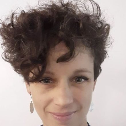
12:30 · Reach
Irene Freni
Médecins Sans Frontières (MSF)
Intersectional GIS Advisor, GIS Centre
GIS at MSF: from tool of War to tool of Care
After spending several years in MSF projects (South Sudan, Uganda, Guinea, DRC) as an architect and logistician, Irene fell in love with GIS during the 2014–2016 Ebola outbreak. She therefore went back to study Geospatial Science and Technology at the University of Tor Vergata and began her second career with MSF in 2021 as the GIS Advisor of MSF France, before becoming the Intersectional GIS Advisor in 2025.
-
ST

13:15, closing talk
Simone Tropea
Corpus International
Journalist, war correspondent. Co-founder and Managing Director of Corpus International
What a map doesn't say: building the civilization of love
Simone Eligio Tropea is a philosopher, writer and geopolitical analyst. He holds a PhD in Philosophy from the Universidad Rey Juan Carlos in Madrid and studies the relationships between ideologies, religions and political power.
He lived for three years in Jerusalem and has worked in several scenarios of crisis and political transformation, from Ukraine to Syria, from Israel and Palestine to Cuba and Latin America. He writes for Limes, focusing in particular on the cultural and ideological roots of contemporary conflicts.
His books include «Il vero problema sono gli stupidi» (2018), «Generato e non creato» (2021), «Una guerra metafisica» (2024) and «La religione del caos mondiale» (2026).
He is co-founder and managing director of Corpus International, director of Altri Sud and managing director of the Fondazione Le Idee di Chicco.

Morning moderator
Prof. Flavia Marcacci
Flavia Marcacci is Associate Professor of History of Science and Technology at the University of Urbino “Carlo Bo”, in the Department of Pure and Applied Sciences. Born in Marsciano (Perugia, 1976), she graduated in Philosophy from the University of Perugia and holds two doctorates, from the Pontifical Lateran University and the University of Urbino. From 2013 to 2024 she taught History of Scientific Thought at the Faculty of Philosophy of the Lateran; she has also taught Philosophy of Science at the University of Notre Dame's Rome Global Gateway and was a visiting professor at the University of Lille. Her work focuses on the history of logic, mathematics and astronomy, from antiquity to Galileo, and on the relationship between science, philosophy and theology. She has interests and coordination experience in epistemology and in science and technology education for the promotion of peace. Specifically, she previously directed the Cycle of Studies in Peace Sciences at the Pontifical Lateran University in Rome. Her books include «Galileo Galilei, una storia da osservare» (2015), «Intervista a Galileo» with William R. Shea (Carocci, 2015) and «Cieli in contraddizione. Giovanni Battista Riccioli e il terzo sistema del mondo» (2018). She has received the Del Monte Medal for the history of science.
Attend
- When
- Tuesday 1 December 2026From 9:00 to 17:30
- Where
- Sala della ConciliazionePalazzo dei Priori, Piazza del Comune, AssisiAfternoon workshop and mapathon: Sala DigiPASS in Santa Maria degli Angeli, Palazzo del Capitano del Perdono, Piazza Garibaldi, Santa Maria degli Angeli
- Admission
- FreeThere is a single registration: you can also select the afternoon in the form.
Add to calendar
Register
Registration is free. After submitting you will receive a confirmation email with your personal code.
How to get here
The Sala della Conciliazione is in the Palazzo dei Priori, in Piazza del Comune, in the heart of Assisi's historic center.
By train from Rome
From Roma Termini there is a direct train to Assisi, with a few departures a day. Alternatively, take a regional train with a change at Foligno.
Assisi station is in Santa Maria degli Angeli, down in the valley: to reach the center, take the city bus or a taxi.
By train from Milan
There is no direct connection. From Milano Centrale take the high-speed train to Firenze Santa Maria Novella, then a regional train to Assisi (some direct, others with one change). Alternatively, you can travel via Rome.
The journey takes several hours: to be in the room by 9:00 you may want to consider arriving the day before.
By car
From Rome it takes about 2 hours 20 minutes. From the north: A1 to the Valdichiana exit, then towards Perugia and the SS75 expressway to the Assisi exit.
Recommended parking is shown on the map below.
Where to park
The most convenient paid parking for Piazza del Comune and the Palazzo dei Priori.
- Mojano: the most convenient for reaching Piazza del Comune.View on Maps
- Piazza Matteotti: in the upper part of the town.View on Maps
- Porta Nuova: at the south-eastern entrance to the town center.View on Maps
- Giovanni Paolo II: near the Basilica of Saint Francis, usually the busiest.View on Maps
Indicative information: check timetables and fares before you travel on Trenitalia and Saba (parking).
Organized by FIWARE Innova I-Hub in collaboration with TeamDev Ecosystem
FIWARE Innova I-Hub
FIWARE Innova I-Hub is a non-profit association that promotes technological innovation in Italy through training, consulting and co-design of technology solutions. It is the first Digital Innovation Hub of the FIWARE network active in Italy and supports public bodies and companies in their digital transformation, particularly in Smart City and Smart Agri-Food, with the aim of turning territories into «Smart Lands» capable of generating wellbeing and a better quality of life.
TeamDev Ecosystem
TeamDev Ecosystem is an Esri Gold Partner, specializing in developing Geographic Information Systems for the benefit of Sustainable Development stakeholders.